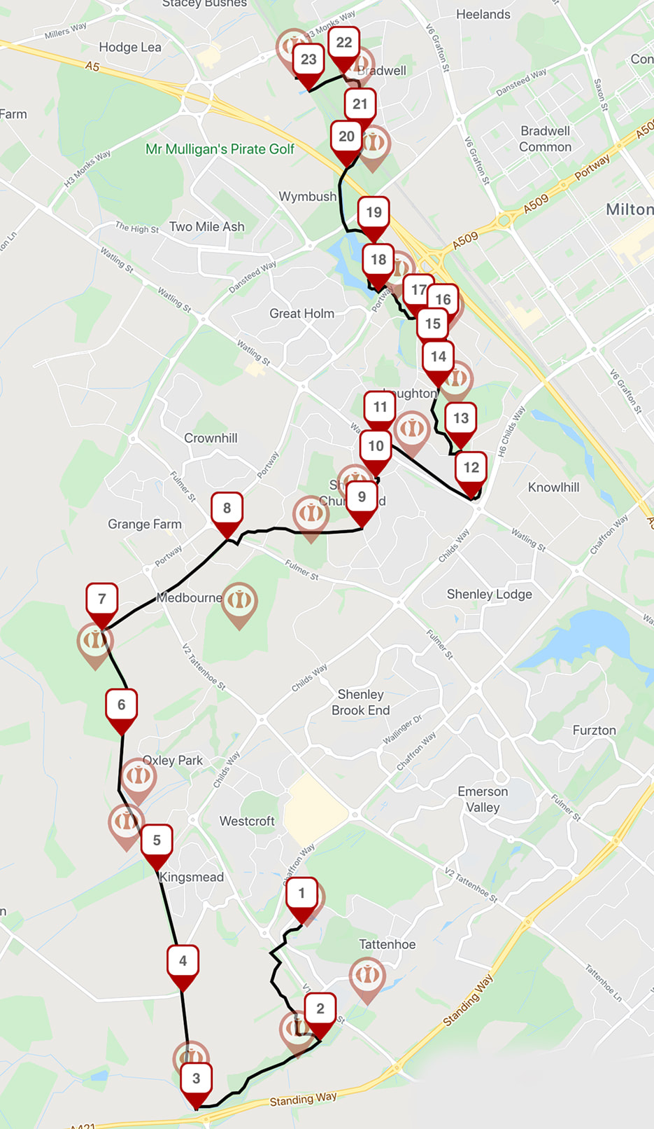
The Pilgrims' Trail
|
1. Head off through the hedge
St Giles Church, Tattenhoe: After exploring the church and its surroundings head back to the car park and take the footpath that leads through the middle of the hedgerow away from the church. Follow the path around the trees and then across the footbridge over Snelshall Street to join the redway left into Tattenhoe Valley Park. 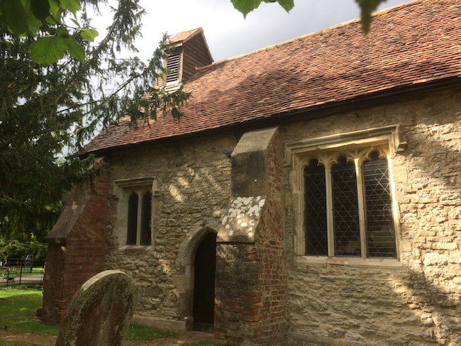
St Giles’ was in the possession of the monks of nearby Snelshall Priory from 1167 until the dissolution of the monasteries in 1538. It was then reconstructed using material from the demolished Priory including the archway of the main door and the base of the Baptismal font. To the left of the south entrance to the church there is a canonical sundial carved into the stone. These are sometimes called scratch dials due to their appearance and were used for marking the ecclesiastical services and canonical hours established by St. Benedict. They are usually found about four to five feet above the ground in a wide variety of designs, from semi-circles of dots to complete circles with associated radii. In spring the church is circled with violets and primroses and in May the hawthorn trees are dusted with heavily scented blossom. The yew trees surrounding the Church are believed to be around 850 years old. The land to the south of the church is a scheduled ancient monument. Though it has been ploughed almost flat, excavations have shown remains of medieval village structures. Within this complex, three ponds survive from a substantial system. They may have been medieval fish rearing ponds similar to others along the trail or landscaped water gardens associated with a later manor house on the site. Medieval Tattenhoe would have been quiet and relatively isolated and by the 16th century the area was deserted, except for three scattered individual farms. It is not clear why this happened but it may have been affected by the decline of Snelshall Priory, plagues and its isolated location. Until relatively recently, the Church was only used during summer and Christmas and solely lit by candles. It is now a part of the thriving Watling Valley Ecumenical Partnership and offers a wide range of services.
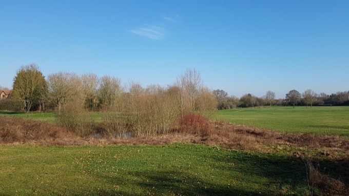
2. Hedgerows and pond
Follow the path as it runs alongside hedgerows a striking veteran pollarded ash tree and a large pond until you reach the junction which is signposted to Tattenhoe Park North East. A short diversion to the left takes you to the Water Spinney a Scheduled Monument but otherwise take the right hand path that follows the brook upstream in the opposite direction. 
Tattenhoe Valley Park is part of the larger collection of parkland that runs through the city of Milton Keynes and provides green space for walkers, cyclists, horse riders. The park includes contiguous areas of semi natural grassland, unimproved hay meadows and pastures. Recent national estimates indicate that there are less than 10,000 hectares of these important grasslands remaining in the UK, having declined by about 94% in the last 50 years. In Milton Keynes these areas are looked after and preserved by the Parks Trust. As you walk through look out for a striking veteran pollarded ash tree and a large pond. The landscape of Tattenhoe attracts and supports a wide variety of wildlife and the local natural history society reports sightings of: Wren, Song Thrush, Blackcap, Garden and Willow Warbler, Common and Lesser Whitethroats, Wheatear, Whinchat, Kingfishers, Little Egrets, Hobbies, Peregrine, Raven, and Ring-necked Parakeet. Marbled White, Common Blue, Dingy Skipper, Painted Lady, Clouded Yellow, Small Heath, Purple Hairstreaks, Chimney Sweeper, Scarlet Tiger and Hummingbird Hawk-moth Southern Hawker, Black-tailed Skimmer, Banded Demoiselle, Willow Emerald Damselfly, swarms of Azure and Common Blue Damselflies , Brown Hawkers, Broad-bodied Chasers Emperor Dragonfly, Common Emerald, Migrant Hawker and Common Darter. Foxes, Badgers, Muntjac deer, Roe deer, Bank Vole, Water Shrew, Weasel, Hedgehogs Common Pipistrelle, Noctule and Serotine. Common Frogs and Toads, Common, Palmate and Great-crested Newts and Grass Snake. Sticklebacks and small shoals of Rudd, and Swan Mussels.
4. Shenley Road
Walk past Tattenhoe Bare Farm to your right and the old Shenley Road on your left on the way to the site of Snelshall Priory. The new housing estate of Kingsmead lies to your right. 5. Briary Plantation
Pass Briary Plantation to your left before the trees open to the site of the earthwork remains of Snelshall Priory. A footpath runs along the edge of the plantation to Whaddon meaning ‘hill where wheat is grown’. The earthworks of the priory can be seen in front of fine open views to Whaddon Hall an MI6 outpost of Bletchley Park during WWII. 
SNELSHALL PRIORY: The earthwork remains of Snelshall Priory are a Scheduled Monument set in open fields on the edge of the city. The priory is believed to have been founded around 1147 as a cell of Lavendon Abbey by Premonstratensian canons. By 1204 this cell had failed and the site passed into the hands of the Benedictine order. Early monastic life in England was heavily influenced by the obscure Italian abbot St Benedict (c.480-550), whose famous ‘Rule’ (actually a set of precepts) laid out a detailed code for monastic living and worship which soon spread across much of Europe. The endowment for Snelshall comprised the land on which to build the Priory along with rights to take ‘husbote’ (wood to repair buildings) and ‘haybote’ (wood to repair fences) and enough underwood for making bread and beer and ‘quittance of pannage for hogs.’ The buildings were constructed sometime after 1219 and dedicated to St Leonard, famed for curing the sick. There were never more than half a dozen monks and in 1321 it was recorded that the building was in poor repair and the brothers were having to beg for even the necessities of life. By 1529 the remaining monks were ordered by the Bishop, in what appears to be scandalous circumstances, to dismiss all women, married or unmarried from the monastery, retaining only two of more than forty-eight years and of unexceptional character as servants. However, it has been suggested by some historians that the notion of corruption and immorality in the Catholic Church was potentially overstated as Rome was increasingly questioned as a canonical authority.
|
WATER SPINNEY: A medieval pond complex sits just off the trail through this small woodland spinney. Consisting of a substantial earthen dam, it would have held back the waters of a small stream to create a rectangular fishpond up to 350m long and 100m wide, orientated south-west to north-east.
A spinney, according to Oliver Rackham in The History of the Countryside, refers to a wood made up of thorns - probably bramble and blackthorn - which were harvested and used to protect the young plants of a newly planted hedge, or to protect the regrowth of a hedge newly cut to the ground for underwood. The spinney contains an established rookery and is carpeted with bluebells in spring. The woodlands in Tattenhoe are also home to sparrowhawks and tawny owls. The whole area is rich in wildlife, which has been well documented by Milton Keynes Natural History Society.
3. The old way
Follow the footpath to the edge of the park and take a right turn up into a hedged enclosure where we join an old bridleway which has since been adopted as part of the Milton Keynes Boundary walk the Midshires Way and Swans Way - part of the UK's network of long distance footpaths. 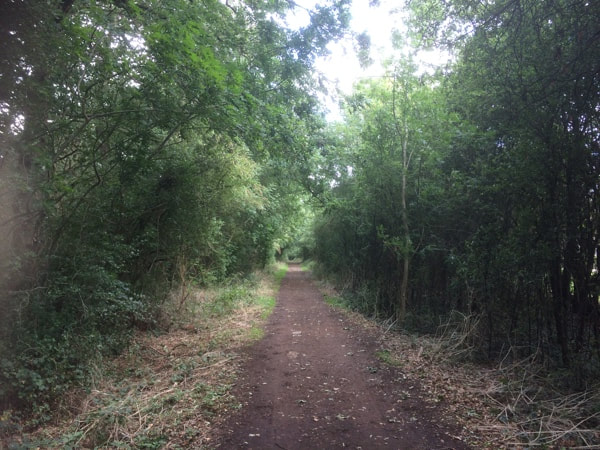
The Milton Keynes Pilgrim Trail follows an old footpath down the western edge of the city. There are no records of pilgrims walking this exact route but the track passes the site of Snelshall Lodge, a building which until the turn of the twentieth century marked the edge of the grounds of Snelshall Priory. Further to the north it also meets with a medieval green lane at Shenley which heads into the village and its church. The path here remains a public right of way and its attractive aspect has led to its inclusion in a number of long distance footpaths including the North Bucks Way, the Midshires Way, Swans Way and the Milton Keynes Boundary Walk. The track thereby links Milton Keynes with the Chiltern Hills in South Buckinghamshire, through the Midland Shires of England to the Pennine Hills in Derbyshire, with Salcey Forest in Northamptonshire, the Ouse Valley Way to East Anglia and with a 60 mile perambulation around the edge of the city. Since the Pennine Way was first proposed in 1935 there are now many long and medium distance footpaths across the country. These footpaths usually adopt existing rights of way and are sometimes conceived around a theme or a landscape feature. This might include the haunts of local historical figures, following the source of a river to the sea, or the footsteps of an historical pilgrim route. Routes are often waymarked with signposts and roundels to help walkers keep on track.
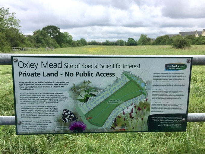
This ancient meadow is a protected Site of Special Scientific Interest. There is no public access but it can be clearly appreciated from the gate. Surrounding the meadow are tall, ancient hedgerows which contain a rich diversity of shrub and tree species including hawthorn, pedunculate oak, blackthorn, buckthorn, white willow, field maple, ash and elder. It contains nationally rare plant communities including meadow foxtail and sweet-vernal grass. A stream runs through the middle of the field and attracts meadowsweet to grow - still an important medicinal plant in use today and a forerunner of aspirin. It would have been a useful medieval strewing herb - scattered on the floor and crushed by walking, it’s scent of new mown hay and almonds would have masked a multitude of unwelcome smells. There are a number of plants present which are indicative of a long history of traditional grassland management; these include pepper saxifrage (Silaum silaus) found over quite large areas, sneezewort (Achillea ptarmica) as well as adder's-tongue fern (Ophioglossum vulgatum) and betony (Stachys officinalis). Species rich meadows like Oxley Mead, are one of the most diverse and valuable habitats found in the country but have declined by 97 per cent since World War II. Precious meadow wildlife including the green winged orchid, bumblebees and birds such as skylark and meadow pipit are in alarming decline.
|
|
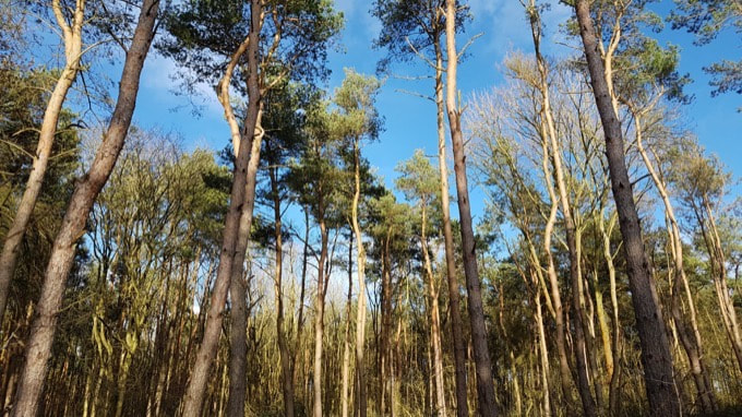
6. Into Oakhill Wood
Pass through a large area of naturally regenerating scrub rich with butterflies during summer before the path leads into Oakhill Wood now a mixture of ancient tracts and new plantations. Woodhill Prison is hidden by the trees to your left and as you reach the northern edge of the wood the view opens out to Upper Weald and Beachampton. 7. Turn Right
At the top of the wood. follow the Swans/Midshires Way right turn past Lawn Farm. The path then passes under Tattenhoe Street and emerges into Medbourne where it connects with Oakhill Road known as a medieval trackway and appearing as a ‘Green Lane’ on 16th century maps. Walk along a sheltered double hedgerow past Shenley Wood to your right. A short walk from to Westbury Arts Centre beyond the wood with the medieval village of Westbury long buried under development. 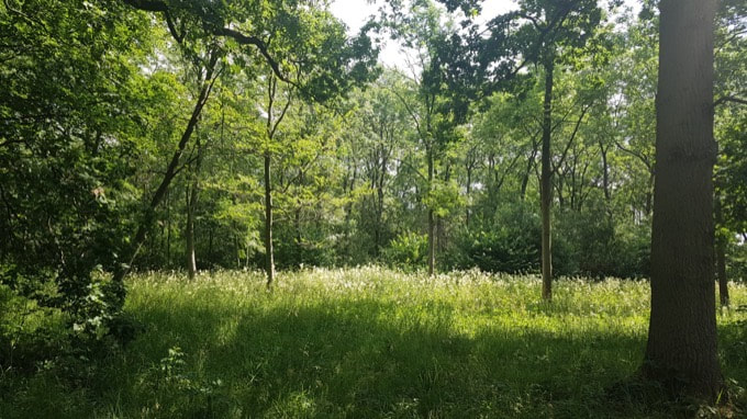
A woodland in this area was mentioned in the Domesday Book and may have at some points been managed as part of Whaddon Chase. As the medieval settlement at Shenley grew, some of the wood would have been cleared for the creation of wood pasture. The modern word Shenley derives from ‘Sene’ or ‘scïenan’ meaning bright and ‘Lai’ or ‘lēage’ (now ‘ley’), meaning clearing. The wood appears as ‘Shenley Park’ on the Salden Estate Map of 1599. By this time, the formation of wood banks and fencing for managing stock animals would have been common. You can see a substantial earth bank to your right as you follow the trail towards Shenley Church End. The path here is flanked by mature shrubs and extensive Blackthorn hedges.
The wood itself is classified as Ash, Field Maple & Dog’s Mercury Woodland, which are typically wet woodlands found on clay. Bluebells, wood anemones, primroses and early purple orchids can be found in spring and the large stands of bramble in the woods are used by nectaring butterflies like the white admiral and silver washed fritillary. This butterfly has made a dramatic recovery having not been recorded locally since the 1970s. A revival in the traditional ‘coppice with standards’ approach to woodland management has resulted in a resurgence in dog violets, their major food source.
9. Fingerpost
Continue down Oakhill Road to the junction with Shenley Road. To your right is an example of a 19th century cast-iron fingerpost sign which have become rare since the 1964 adoption of the Worboys Committee’s standardisation of road signs. The path breaks from the Swans Way / Midshires way with a left turn here to follow the Shenley Road past St Mary's Church. A short walk around the church will bring you back to the trail. 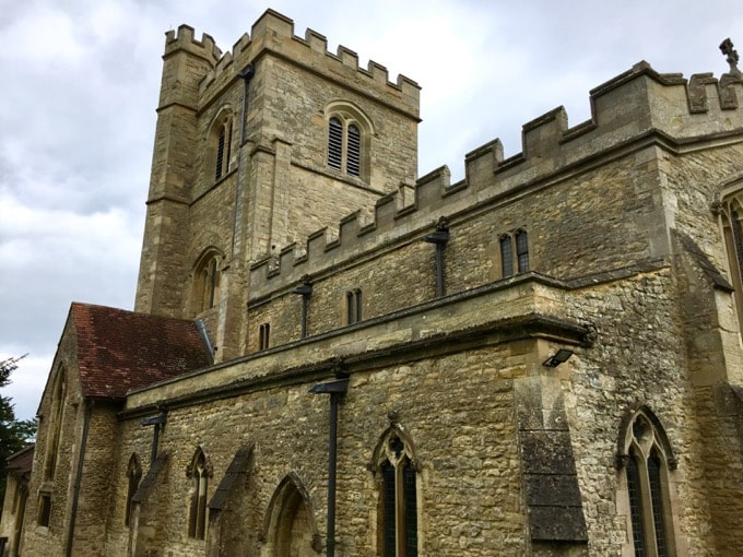
We would expect to find a church at Shenley Church End and the parish church of St Mary’s has been here in some form or other since the mid-twelfth century. Churches often reflect the architectural styles that have been employed through various additions, rebuildings and reorderings and St Mary’s is no exception. The interior was given a particularly striking makeover of wood panelling, encaustic floor tiles and stencilled walls from its 1888-1890 restoration.
Although not competing with the some of the more decorative, grotesque and explicit carvings and gargoyles of green men and sheela-na-gigs found in other places there is a quiet and calming collection of medieval faces carved into the stonework of the window and door corbels around the outside of St Mary’s. Regal and majestic faces whose origins are difficult to trace have been looking out on, or perhaps looking out for, the congregation as they enter and leave the church for hundreds of years. According to Arthur Cock’s 1894 guide to the Church Bells of Buckinghamshire, the five bells in the tower at Shenley were locally thought to have been “brought from somewhere over the sea and that one was thrown overboard on the way”. This story, explaining why the ring of bells was one short of the customary six, is quickly countered by Cock who points out that all of the bells were made in England. The oldest of these was cast by Robert Burford in the early 15th century.
London Road is a quiet residential street running through the village of Loughton but was originally, from Roman times, one of the main north to south routes in the country. Before the M1 was built in the 1950s traffic on this then busy A5 was diverted slightly west, away from the village, into what is now the Milton Keynes V4 grid road. John Higgs, author of Watling Street, a kind of biography of the original route, lyrically describes “a road of witches and ghosts, of queens and highwaymen, of history and myth, of Chaucer, Dickens and James Bond. Along this route Boudicca met her end, the Battle of Bosworth changed royal history, Bletchley Park code breakers cracked Nazi transmissions and Capability Brown remodelled the English landscape.”
The road runs the length of Milton Keynes with old coaching inns still operating in the towns of Fenny Stratford, Stony Stratford as well as the Talbot Inn and Fountain Inn here in Loughton.
14. Village life
Turn off Whitworth Lane and follow the redway footpath that leads straight ahead before taking a right turn onto Leys Lane over the brook and then left onto School Lane. The old pub sign on the building ahead hints at the history of village life here in Loughton. 15. Wooded lane
The trail follows School Lane to the right as it becomes a quiet wooded road that leads up to the centre of the village and All Saints Church which is approached through a gate into the churchyard. 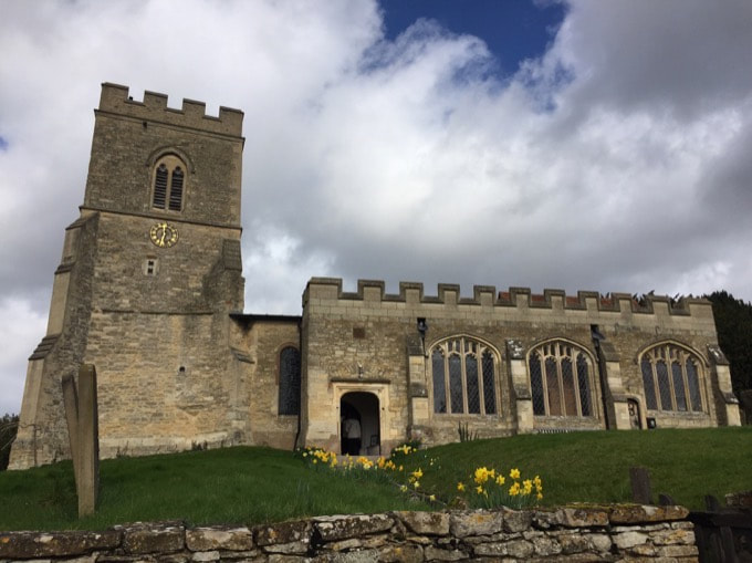
A church has been recorded in Loughton since the early 13th century and parts of the present building date back to that time. In the intervening centuries there have been many changes to the building and additions to what's inside it: there are several monuments to wealthy local residents, a 16th century poor box and a ring of six bells.
In English church bell ringing, a full peal means ringing a set of bells in different sequences until they have been played in every possible order. For six bells this adds up to 720 different permutations. This art of bell ringing, based on changing through these sequences, evolved during the 16th and 17th century into what is now known as change ringing.
Half of the bells of All Saints were originally cast in the 15th and 16th centuries and another three were installed in the early 20th. In 2018 two of these bells were part of a major refurbishment programme which included recasting both the tenor and treble. The first full peal of the new bells was heard from the tower in July 2018 to celebrate the 800th anniversary of the church.
The walls of the bell tower are nearly five and a half feet thick (1.5m) with additional supporting buttresses around the base. Inside are monuments to Hugh Parke, rector of the parish from 1485 to 1514 who bequeathed land to the upkeep of the church and the local poor. There are also arms of local landowners including the Cranes and the Mortofts.
"Try to imagine an open city, a city of trees, where you don’t feel crushed and overwhelmed by the buildings, by the dust and bustle and noise. Try to imagine a city in which trees and green parkland are dominant features: where footpaths and hedgerows, canal and river play almost as important a part as the buildings themselves...Milton Keynes will make use of all the natural assets of the Buckinghamshire countryside – the woodlands, hedgerows, rivers and streams...a great linear park – 40 square kilometres of open spaces criss-crossed with bridlepaths and footpaths that have been in that part of the world for as long as anyone can remember...When the plan for Milton Keynes was first conceived, the Linear Park was seen as the main sanctuary of nature within the city. It is designed for passive activity where the inhabitants of the city can walk in peace and quiet surrounded by green...The linear park is seen as an emblem of the City’s determination to create a green environment, free of pollutants and as a place of natural beauty where leisure can be a social or a solitary past-time." from Milton Keynes: A new city comes to life, Milton Keynes Development Corporation, 1972. “No matter how prosperous or poor the future, a logical continuous system will be assured, linking places of interest within the park and beyond the city boundaries. The initial park area consists of common land, flood land, water balancing lakes and designated archaeological sites. The land will be held open for future leisure purposes as grassland in agricultural use, maintained by cattle sheep and deer in the early years. Most planting in the parks will be indigenous wetland species: willows, alder, poplars etc., thinly planted along the rivers, but with a dense back up of elm, oak, ash, maple and lime towards the park fringes.” from Architectural Design, 6/1973, p.360. As the Loughton Brook flows north, it would have been adapted as it flowed through the site of Bradwell Abbey to provide drinking water, a source of water for the fishponds and a source of running water for flushing out the monks’ Necessarium - their communal latrine.
21. Wild garlic
After leaving the railway line the path edges along some modern housing with woodland on the left. Wild garlic is abundant here in late Spring and the path continues through a yew tree archway into St Lawrence's Churchyard. Outside the opposite gate and opposite the YHA are the remains of a Norman castle. Take the left turn out onto Vicarage Road and the village of Old Bradwell. To the right are the two village pubs the Vic and the Albert. 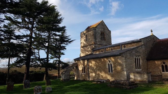
The church is located by the old Manor Farm (now a Youth Hostel) and the 13th century Motte and Bailey castle remains. The main parts of the church were built in 1210 with a tower added around 1380, using materials salvaged from Bradwell Abbey and redundant bells from the church at Snelshall Priory. A north door was also added at this point and a carved consecration cross, showing that a Bishop had consecrated the church, can still be seen to the right as you enter.
There is an intriguing 13th century inscription to be found on the chancel arch confirming the church’s dedication to St. Lawrence. He can be seen in one of the church windows as he is often pictured in art, with the gridiron on which he is supposed to have been roasted to death. Also carved into the arch are the words VIGINTI DIES RELAXIONIS (which is Latin for ‘twenty days relaxation’) which has been suggested means that for some reason, visiting the church would mean 20 less days spent in purgatory.
Though it is close to Bradwell Abbey, there was no formal relationship between the Priory and St Lawrence’s church. The first vicar at St Lawrence, Henricus, was designated vicar in 1223 by the newly founded Tickford Priory, in Newport Pagnell. There have been 57 vicars since then. One of them, James Hume (1729-1734) was an intellectually curious man whose library was said to contain books on herbs, kitchen gardens and bee-keeping amongst more pious tomes on theology and sermons.
From the time of St Augustine's mission to re-establish Christianity in AD 597 to the reign of Henry VIII, monasticism formed an important facet of both religious and secular life in the British Isles. Settlements of religious communities, including monasteries, were built to house communities of monks, canons (priests), and sometimes lay-brothers, living a common life of religious observance under some form of systematic discipline. It is estimated from documentary evidence that over 700 monasteries were founded in England. These ranged in size from major communities with several hundred members to tiny establishments with a handful of brethren.
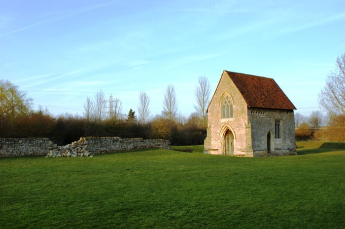
The Benedictine complex at Bradwell Abbey was founded around the middle of the 12th Century as a cell of Luffield Priory - now under Silverstone racetrack. It fell on hard times early on in its history, exacerbated by the devastating famines of the early 1300s and the advent of the Black Death. Around 1330 however, there were enough resources to add the chapel to the west wall of the monastic church, ostensibly to enclose a niche containing a statue of St Mary with a reputation for healing and miracle working, though this is undocumented.
The chapel possibly functioned as a place of pilgrimage for lay visitors, separate from the monastic complex, a suggestion supported by the discovery of a Thomas Becket pilgrim badge on the site during early Milton Keynes Development Corporation archaeological excavations.
Inside the Chapel are a series of medieval wall paintings, unique in England. They were discovered in the 1960s when dripping water began to dissolve the layer of whitewash covering the paintings. The ‘Pilgrims painting’ shows four kneeling figures, thought to be pilgrims. Each holds a different object symbolising their prayers in votive offering. One holds a staff - possibly in thanks for a cure, one holds a wax or wooden head and one holds the image of a figure kneeling in prayer.
|
Oakhill Wood is a fragment of the historic hunting forest of Whaddon Chase. The ‘idea’ of a forest was introduced by William the Conqueror, partly to legitimise and control common customs of woodland management but also to introduce more deer. His obituary describes how he:
“...set up great protection for deer (deorfrip) and legislated to that intent, that whosoever should slay hart or hind should be blinded….he loved the high-deer as if he were their father.”
The wood is now largely plantation woodland though it does contain some notable veteran pollarded oaks. Recent removal of conifers in part of the wood has created a sunny clearing in an area known to be used by the Silver Washed Fritillary butterfly. The area around the wood combines hedgerow, woodland and scrub. Scrub is an ecologically important landscape of woody shrub species. Hawthorn scrub is associated with many nesting birds including migrant warblers and nightingales. During the winter, scrub is important for feeding birds such as starlings, thrushes, finches and buntings. Queens of some bumblebee species will hibernate in scrub over winter. Mature blackthorn stands are the preferred egg laying sites for the very rare black hairstreak butterfly and badgers are known to use elder scrub both for cover and as a food source. This landscape provides an important habitat for plants, invertebrates, birds and mammals between the open semi-natural grassland of Tattenhoe Valley Park and the woodlands of Shenley and Howe Park.
8. To the Castle
The path turns a dogleg under Fulmer Street before joining back up to Oakhill Road. Medieval fishponds used to be in the field to your left as the path climbs gently to Shenley Toot. The castle sits above the surrounding woods and valleys and is the oldest site on the trail. 
Shenley appears in the Domesday book as Senelai, an Old English word meaning bright clearing. There were two separate manors here in 1086, both owned by Hugh, Earl of Chester:
In Seckley Hundred Hugh holds of the earl Shenley Church End. It is assessed at 2 hides. There is land for 10 ploughs. In demesne are 3 ploughs; and 5 villans with 6 slaves have 5 ploughs and there could be 2 more. Meadow for 5 ploughs, woodland for 50 pigs. It is and was worth 100s ; TRE 6L. This manor Burgheard, a housecarl of King Edward, held and could sell.
In Senelai Hugh holds of Earl Hugh 5 hides as one manor. There is land for 5 ploughs, and there are 4 ploughs and could be a fifth. There are 8 villeins, meadow sufficient for 5 plough (teams) and woodland (to feed) 50 swine. In all it is and was worth 3 pounds ; TRE 4L. This manor Burgheard, a thegn of King Edward, held.
The most striking visual remains of this history can be seen at Shenley Toot, a listed historic monument which includes the earthworks of a Norman motte and bailey castle and a later Medieval manor complex. Motte and bailey castles acted as military forts, defensive strongholds, aristocratic residences and administrative centres. In Shenley the castle was adapted during the middle ages and the site passed through the hands of various owners. There are two separate moated enclosures visible in the remaining earthworks and the last building on the site, located on a rectangular on a platform in the middle of one of the moated areas, is recorded in the 1905 Victoria History of the County of Buckingham as having been pulled down by Matthew Knapp in 1774.
10. Shenley Road
Continue through the village on the Shenley Road. If it is September, you might pause to gather delicious grapes publicly planted around a decorative pergola in a small square just before the path passes under the A5 road bridge to arrive at the Talbot Inn. 11. London connections
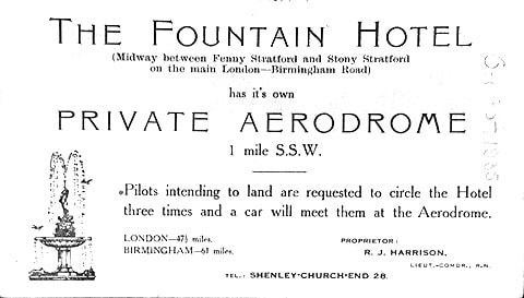
Turn right at the Talbot Inn onto London Road or Watling Street. This was once the main route to the Midlands and North Wales but now a much quieter residential run of old and new housing. Carry on past the village store and thatched roof of the Fountain Inn once known for its private aerodrome where aviators from London could land their planes before dinner. 12. Loughton Moat
Follow the footpath as it curves left and crosses Little Meadow leading up to Ashpole Furlong. From there the church of All Saints Loughton appears above a good view of the large and extensive earthworks and moated site of medieval Loughton. 13. Earthworks
Turn left on to Whitworth Lane with its modern houses on your left and the historic remains of the earlier settlement and its Medieval fishponds to your right. Look out for more glimpses of All Saints Church appearing ahead. 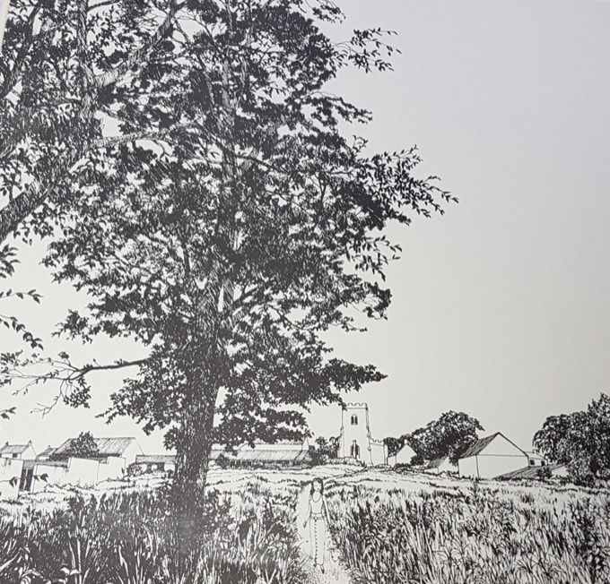
The paddocks to the right of the footpath as it snakes along Whitworth Lane contain the remains of a medieval moated site and pond system. All Saints Church and Central Milton Keynes can be seen on the horizon and the Loughton Brook flows through the top edge of the site.
Between the moat and fishpond to the west of the site and Loughton Manor in the east, are a series of earthworks of medieval and post medieval date, comprising the remains of building platforms with associated crofts and linear field boundaries. Seven building platforms have been identified, all of which lie adjacent to the old course of the Loughton Brook, the brook having been rerouted to its current position in the 1930s. Fishponds were an important part of the medieval landscape in Milton Keynes, and many still survive though most no longer hold water, or fish. They were made by damming a stream and were often long and narrow. They were usually lined with clay or timber. A sluice at one end would allow the excess water to escape.
Each pond would contain fish of different ages and only the adult fish would be eaten on days when meat from land animals was forbidden. Sometimes this could be up to 150 fasting days each year. There was no lack of grumbling about the rigours of fasting,;many people complained about being deprived of meat for the long, hard weeks of solemn contemplation of their sins. At Lent, owners of livestock were warned to keep an eye out for hungry dogs frustrated by a "hard siege by Lent and fish bones".
16. Leaving the churchyard
Take the steps down from the churchyard and turn left onto Church Lane which then veers left into Bradwell Road as you leave the village. 17. Bradwell Road
Several medieval routes ran from the village of Loughton: the (possibly Roman) road known as Portweie to Newport Pagnell the more recent Bradwell Road connecting Old Bradwell to the Shenleys and the track along the brook to Bradwell Abbey which we pick up as a right turn opposite Lucy Lane onto a footpath through the Loughton Valley Park. 18. Portweie
After passing underneath the high bridge span of the H5 grid road (named Portway after the old road to Newport) follow the right hand path when it reaches the corner of Lodge Lake. A Chinese style pagoda currently a restaurant can be seen across the water. The path continues to follow the back of the lake part of the city's flood defences which is mostly now home to anglers and herons. 19. Lodge Lake
Turn left when the path rises past an outdoor gym to join the redway at Lodge Lake car park then take the right turn that meets up and follows the brook as it passes underneath another road bridge this time the H4 Dansteed Way and on to another the fast and noisy A5 diversion that runs through the city like an expressway. 20. Ridge and Furrow
After emerging from the A5 underpass the path takes a right turn signposted Bradwell village and passes between some woodland and a ridge and furrow field system which is now laid to meadow. Keep on this path as it crosses the London and Birmingham railway line. A step free option follows the path along the brook signposted Loughton Valley Park North. 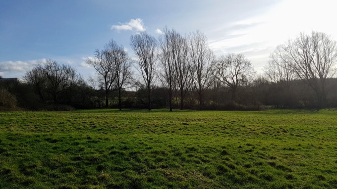
The meadow borders an old quarry working known locally as the Hills and Hollows. This area of young, dry woodland supports significant colonies of primroses and is full of intriguing clearings and a maze of paths, at one point in time used by local BMX cyclists. The meadow itself is surrounded by established hedgerows of blackthorn, hawthorn, dog rose and elder. The earliest folk tales praise elder's ability to ward off malevolent spirits, and to undo evil magic. But there are two very different folktales associated with the elder, with a later overlay of bad press imposed by the Church, in their need to eradicate the old Pagan religion. These superstitions say that the tree itself brought death, that a malevolent spirit dwelled within it. These suggestions grew out of fear of the village hedge witch or wise woman who would have used the Elder in many of her herbal remedies. The relationship between Bradwell Abbey and surrounding meadow lands would have been an important one. Kitchen and medicinal herbs gathered from hedgerow and meadow would have been an important part of the self sufficiency of monastic life.
22. Abbey Road
As Vicarage Road turns into Abbey Road take the left hand turn onto a redway that heads back towards the railway line and then follows the brook upstream into the culvert that carries the water through the embankment. 23. Pilgrim Chapel
Just after leaving the culvert follow a path that leads off to the right into the grounds of Bradwell Abbey and its fish ponds. Keep right and follow the path into the woods alongside the railway embankment. After a short few steps the Chapel of St Mary and the end of the MK Pilgrim Trail comes into view. |
