Netherfield Walking Trail
Introduction
Netherfield was one of Milton Keynes’ earliest housing projects. Designed by four architects in the early 1970s - Jeremy Dixon, Ed Jones, Chris Cross and Mike Gold. They previously worked together on various proposals and projects including a number of social housing schemes in London. They went on to design opera houses, galleries and city halls.
This trail takes you around the estate, looking out for different housing styles, landscape features and community spirit, and putting it into the wider context of the early history of Milton Keynes. Parking is available at the local centre but is intended for customers so don't forget to buy some refreshments to take on your walk.
This trail takes you around the estate, looking out for different housing styles, landscape features and community spirit, and putting it into the wider context of the early history of Milton Keynes. Parking is available at the local centre but is intended for customers so don't forget to buy some refreshments to take on your walk.
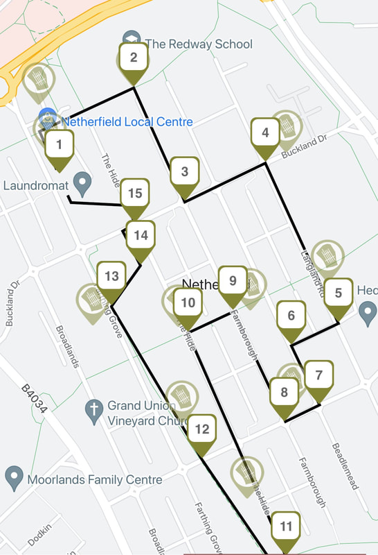
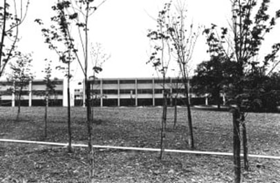
1. Start at the local centreThis heritage trail around Netherfield starts at the local centre which opened here in 1975. Facing the shops turn left to walk along the front of the precinct towards the Doctor's Surgery and then turn right on to the redway that runs along the top of the estate. Follow this path down to the front of Redway School.
|
|
2. Turn right at Redway School
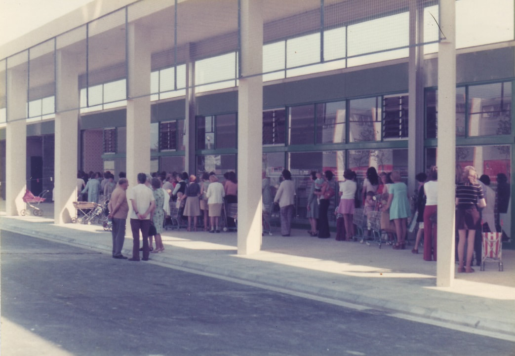
Turn right and walk up the gentle hill of Farmborough. The end of each block of terraces are often designed as small blocks of flats. Turn left when you get to Buckland Drive.
|
|
3. Turn left when on to Buckland Drive
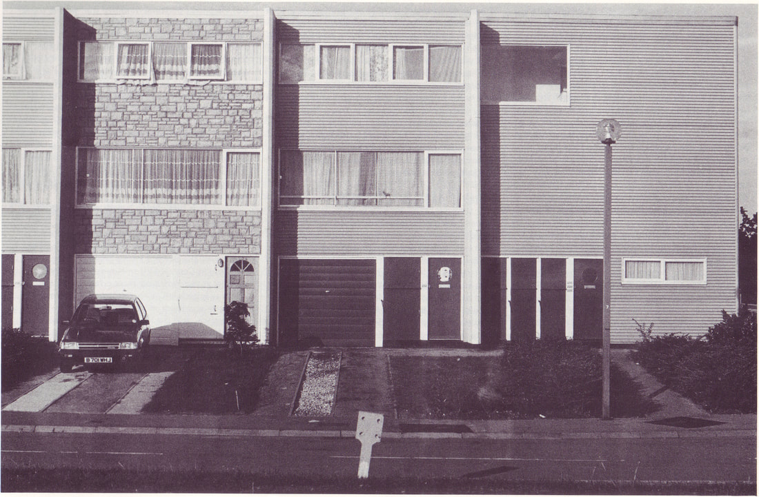
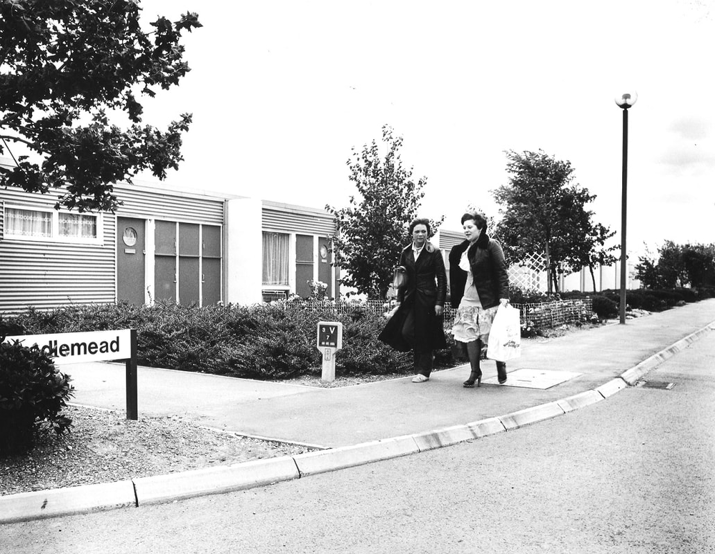
Turn left on to Buckland Drive, past Beadlemead with its single storey bungalows at the top of the hill and carry on to turn right on to Langland Road.
|
|
4. Turn right on to Langland Road
Turn right on to Langland Road where, like most houses on the estate, the bungalows face out on to trees and open grassland. When you reach Langland School look out for a path that will take you between house number 184 and 186.
|
|
5. Turn right between numbers 184 and 186
This path cuts through to Beadlemead. The rear of Netherfield houses either look out on to more grassland or mews style garages. Turn left on to Beadlemead.
6. Turn left on to Beadlemead
Back on to Beadlemead we have now gone downhill a litte so the houses here are now back up to three storey in height. This stretch of Beadlemead, with its facing terraces, has a more conventional streetscape. Turn right on to Barnfield Drive.
7. Turn right on to Barnfield Drive
With Buckland Drive, Barnfield is the second road that runs straight across the estate and leads out on to the grid road on either side. Take the right turn on to Farmborough.
8. Take the right turn on to Farmborough
Here the houses are two storey. The fins in between were originally coloured blue. Carry on up the hill and turn left on to the redway when you reach the Meeting Place. A little further up Farmborough you can see how the angles of the gardens switch from two to single storey.
9. Turn left on to the redway at the Meeting Place
Linking Farmborough with The Hide, this path cuts through the garaged backs of the two streets. Turn left down The Hide.
10. Turn left down The Hide
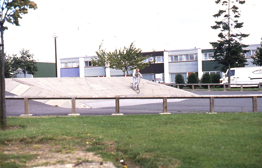
Follow The Hide down the hill past the rows of maisonettes with their distinctive metal staircases to the skate park at the end of the street.
|
|
11. Turn right at the skate park
The redway here briefly follows an original field boundary. Look out for oak trees and hawthorn in the hedgerow before taking the redway up the other side of the park and over Barnfield Drive.
12. Follow the redway over Barnfield Drive
An old hedgerow also crosses Barnfield Drive here as the redway takes us through the main green parkland of the estate on to Farthing Grove, past the Owl and The Pussycat Park.
13. Take the path across the park
Before taking a right turn on to a diagonal path through the trees and grass of the Alphabet Park notice in the other direction the 'desire path' that heads in the opposite direction. This path, unofficially perhaps, exactly follows the route of the old footpath from Woughton to Bletchley. Turn left through the Netherfield Community Garden.
14. Turn left through the Netherfield Community Garden
The community garden is the last remnant of the allotments that were originally part of the Netherfield design. Cross over Buckland Drive and left into The Hide.
15. Turn left into The Hide
Turn left into The Hide and then take the path to the left that takes us back towards the local centre where we started. The path through the precinct follows an old hedgerow and has since been planted with steel pillars to discourage anti-social behaviour.
